Location-data
Rating :
Objects :
Condition :
Picture time :
Accessible :
Parking :
Date :
GPS :
+
1
+
30 min
++
+
10/2010 4/2013
BP
Waddinxveen.
WBN, KVA Dordrecht, Waddinxveen, Vordere Wasserstellung, Noordeinde.

Drive from Waddinxveen towards Boskoop via the Noordeinde. Driving on this road/dike you will see at your left side (west) a polder, and some small road between the houses (private land) brings you to the former anti tank ditch. The German extended the current water way into the size of a anti tank ditch to be a part of the Vordere Wasserstellung in combination whit other obstacles.

The “Erste or Vordere Wasserstellung" was a German line about 30-50 km's land inwards behind the dunes to slow down advancing enemy troops. In case of a landing on the Dutch coast and a break trough, they could fall back on this prepared stopping line from Amsterdam-Alphen a/d Rijn-Gouda-Dordrecht-Moerdijk-Roosendaal. The Germans used the technique of inundation, by setting parts of the land underwater about 60cm deep. They also made light defence objects like small gun emplacements, barbed wire lines and mine fields to close the gaps in between.

Types:
1x Antitank ditch.
4x Dragon teeth's
Holland, Zuid-Holland, Waddinxveen. (2)
See other locations in the Vordere Wasserstellung: Alphen a/d Rijn, Boskoop, Waddinxveen, Gouda, Moordrecht.
Waddinxveen.
WBN, KVA Dordrecht, Waddinxveen, Vordere Wasserstellung, Oude Dreef.

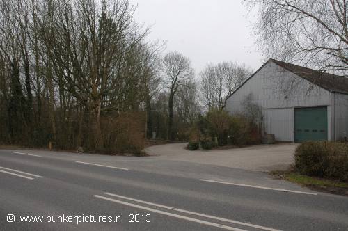
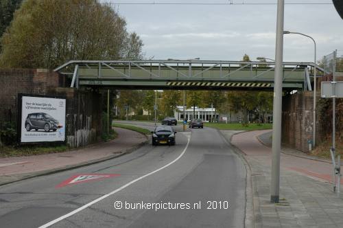
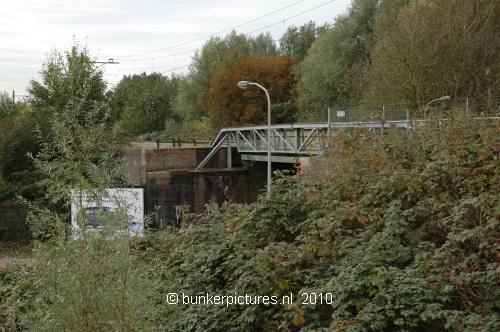
Driving from Gouda via the Juliansluis towards Waddinxveen via N456 and then you take the N454. When you are almost in Waddinxveen driving over the Kanaaldijk, you have to go to the left into the Oude Dreef, towards a railroad viaduct.
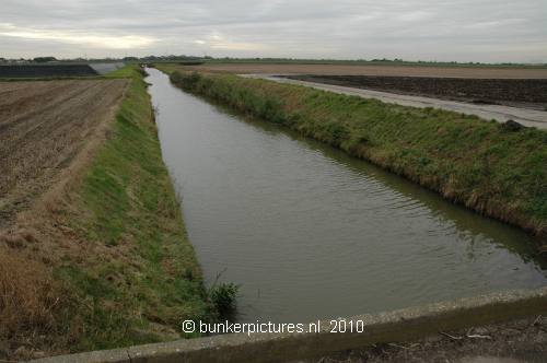
Most part of the railroad track between Gouda and Waddinxveen was part of the Vordere Wasserstellung because of its structure with heights and waterways.

The "Erste or Vordere Wasserstellung" was a German line about 30-50 km's land inwards behind the dunes to slow down advancing enemy troops. In case of a landing on the Dutch coast and a break trough, they could fall back on this prepared stopping line from Amsterdam-Alphen a/d Rijn-Gouda-Dordrecht-Moerdijk-Roosendaal. The Germans used the technique of inundation, by setting parts of the land underwater about 60cm deep. They also made light defence objects like small gun emplacements, barbed wire lines and mine fields to close the gaps in between.

Types:
1x Defensive line.
Rating :
Objects :
Condition :
Picture time :
Accessible :
Parking :
Date :
GPS :
+
1
+
10 min
++
+
10/2010
BP
© bunkerpictures - Dragon teeth's
© bunkerpictures - Anti tank ditch
© bunkerpictures - Defence line